A superb walk - but next time we'll stop in Great Asby
From: Joy Hawker
Date:
15 Aug 2024
We completed the route on 11th August 2024. The guidebook is
truly excellent and although we took OS maps we hardly used them.
The sense of space and remoteness really opens up after
leaving the towns. We saw just handfuls of walkers each day
except for the areas around Malham, Ingleborough and Whernside.
There were too many highlights to list but a quirky one for us
was seeing Shakespeare’s First Folio in the lovely Craven Museum
in Skipton. There are only four on permanent display in the UK.
For the most part the signage along the route was very good
though some signs are a little faded or broken. As with a
previous poster we too got confused around Crummack and had to
retrace our steps.
At times the terrain was challenging for us - very rocky and
also incredibly boggy over The Howgills. We did take the high
route and were lucky for the weather to clear and the views to
open up. Otherwise this would have been a terrible trudge. We
have yet to see Ingleborough with driving rain, low cloud and a
gale blowing (August?!) though we did get to the top.
The most disappointing section was the walk into Appleby after
Great Asby. We’ve now walked in rural Cumbria in the last three
years and our experience of the footpaths does not get better.
The enclosed paths are dreadfully overgrown and often muddy and
it’s a battle to get through. The rest generally is over farmland
that’s heavily grazed by cattle which results in big areas of
“poached” surface ground.
Overall a superb walk and very enjoyable.
Stuart - A good walk, but....
From: Stuart Grant
Date:
11 July 2024
I’ve just completed the Dales High Way for a second time, the
first being in 2016. It wasn’t great summer weather but the rain
held off for most of the time. I deliberately took the low route
from Sedbergh mainly because the weather forecast was for rain
and blustery winds, and this turned out to be true. Other reasons
were that I was staying in Ravenstonedale (the B&B in Newbiggin
has closed) and that my notes from 2016 describe the walk over
the Howgills as being an endless muddy trudge. The low level
paths were also muddy, and difficult in places, but I was a
little more sheltered than I would otherwise have been.
My notes from 2016 also told me that I had trouble
route-finding around Crummack, between Chapel-le-Dale and
Ingleborough. I had trouble again this time, but can’t say if
this was due to poor attention or missing signage. Signs have
certainly gone missing in other places, and I relied on the OS
map with its defined field boundaries on more than one occasion
to confirm my position. This was particularly necessary on the
last day, finding that a temporary cattle fence barred the way to
a gate leading into Cockeld Farm. Having satisfied myself that I
was on route, I rolled under the fence (which may have been
electric) and walked through the open gateway, watched but not
challenged by the farmer.
Some paths were very overgrown, possibly as a result of
the wet summer. The riverside stretch beyond Howe Slacks on the
last day was one example, Dentdale another. I’ve walked up and
down Dentdale several times now, and considering that the Dales
Way, Dales High Way and Pennine Journey all take this route, it’s
surprising how impassable the path is in places.
I stayed in some very good B&Bs, but accommodation is getting
more difficult to find in some places, especially for the single
traveller (I was charged for two in a couple of places, and had
to put up with it for lack of alternatives). Apart from the
expensive pubs, there are no B&Bs left in Sedbergh unless you
walk another mile and a half to the very welcoming Ash Hining
Farm. The Craven Heifer in Stainforth doesn’t seem to provide
accommodation now, so I stopped short in Settle.
All in all, it’s a walk of great variety and the daily
distances manageable (even day 6 into Sedbergh).
I will be recommending it to all!
From: Richard
Date:
30 June 2024
In April I bought the Dales High Way Companion and route guide
off you. I spent from Saturday 22nd to Thursday 27 June last week
walking the Dales High Way. I carried my own camping kit and used
the commercial campsites on the way. Thank you for creating the
route and all the infrastructure around it. Besides the route as
an experienced walker on Long Distance Paths I was very impressed
by-
1. Firstly the accommodation section on the website. This is
where most trails fall down as it gets difficult to see where I
can stay each night. and how I can adjust the daily mileage to
suit the accommodation. I do not think any other trail has so
much up to date accomodation information on it. This more than
anything else enabled me to attempt the Dales Highway rather than
any other route. There are plenty out there and as I live down
south near Bath the Dales are not the usual first choice.
2. The route marking. You had the little roundels consistently
on the route. Thank you for the effort it must have taken to do
this.
3. Finally the strip maps in the route guide. I had OS maps
and compass, but did not need them. The strip maps are excellent.
The notation of gate or stile was 100% accurate, The mapping of
the walls or fences was also 100%. Following the route was
extremely easy. The strip map booklet in the plastic cover fitted
in my shorts pocket very conveniently.
Thank you again for all your hard work creating and
maintaining the route. I will be recommending it to all!
Regards Richard
Train strike 9th May - transport back to Saltaire??
From: Carola & Kevin.
Date:
2 May 2024
We are walking the Dales highway at this moment in time, and we
have just found out that there will be a rail strike on the day. We
have planned to return from Appleby – in – Westmorland to Saltaire.
What is the distance has left us with the problem how to get back.
I cannot find any information on buses from Appleby – in –
Westmoreland to Saltaire or Shipley. A train is out of the question
due to the strike so if anyone can help with suggestions we would
be very grateful.
Regards Carola & Kevin
Fantastic Route
From: Andy Stone.
Date:
15 August 2023
I recently completed this fantastic walk. Beautiful scenery,
some familiar, other parts long awaited, some unknown.
I walked the 6-day schedule at the end of the June heatwave
(13-20th), so no rain except a splattering on my back near
Sunbiggin Tarn and glorious views throughout.
I stayed at pubs, B&B's or Airbnbs. I would especially
recommend the King William IV guesthouse at Settle, lovely
owners, breakfast and superb showers! This worked well but is a
challenge at Newbiggin/Ravenstonedale where there are now only
two (very good) pubs that are expensive for single walkers. The
other accommodation there has closed.
I stayed at the Station Inn at Ribblehead. I'm really pleased
I did as, although it meant a mile of road walking at the end of
the day, you avoid the steep descent to Chapel le Dale and
instead follow the spectacular route along the north escarpment
of Simon Fell and Park Fell, looking across to Whernside and back
to Ingelborough. A real highlight.
The route was clear and straightforward throughout, except for
some very overgrown paths on the last day, and the combination of
maps/OS app and the DHW guide were great.
With the exception of Malham and Three-peaks cross overs it
was very quiet, meeting only half a dozen people each day, and no
other DHW walkers.
Make sure you carry sufficient/extra food and water as on the
first two long days. It is largely open moorland and shelterless
hilltops and so in hot weather you need it. There are no places
to restock (even water) other than start and finish - on day 3
Gordale Hause had an ice-cream van, so that was OK!
Will do to again some time!
Alternative route?
From: Linda B.
Date:
11 July 2023
I'm wondering if you can help? I've booked accommodation at
Ashes Farm following the suggestion on your very helpful site.
I'm just struggling to find the alternative site referred to?
Could you let me know where I can access this?
Tony Replies: Hi Linda, If you
are walking A Dales High Way and have a copy of the Route Guide,
the alternative route avoids Ingleborough Peak and is on maps 13
& 14b. Ashes Farm is on the Gauber Rd., not far from Ribblehead
Station. You can find it by zooming in on the detailed map here:
https://www.daleshighway.co.uk/detailed_route.htm
.
You can also get to it quite easily from Ribblehead. I
hope this helps.
I completed the Dales High Way with my dog Nero.
From: Lewis and Nero Gawthorpe
Date:
17 June 2023
Hi I completed the dales high way from 26th to 2nd June over 8
days with my dog Nero.
I clocked up 101 miles, what a brilliant walk with breathing
taking scenery, historic places and waterfalls. I camped and
backpacked the full walk. 7 nights camp, 6 days on back and 2
days Sherpa. When I got to Appleby i planing to get train back
saltaire but unfortunately they was on strike. (Was absolutely
devastated as we was both ready for home by them) had to get a
hotel and lift the next day. Best walking day- the howgills Best
stay - malham (Gordale scar campsite)
My artinary Day 1 saltaire to addringham (ghyll house camp
site)
Day 2 addringham to hetton (threapland house farm) 2 miles
past hetton in Cracoe)
Day 3 hetton to malham (Gordale house)
Day 4 malham to Stainforth (Stainforth Hall)
Day 5 Stainforth to chapel Le dale ( philpin farm)
Day 6 chapel Le dale to dent (high laning campsite)
Day 7 dent to newbiggin ( high greenside pop up campsite in
ravensdale)
Day 8 newbiggin to Appleby
Also brilliant camp at phipins farm every you need for
backpacking charger lockers, vending machine and cooked food
available.
Please could you follow my instagram page
https://instagram.com/lg_rambles?igshid=NTc4MTIwNjQ2YQ== I
have reels and highlights from the walk on there.
Thanks
Lewis and Nero Gawthorpe.
Just finished
From: Kevin Ball
Date: 21
May 2022
Just recently finished the Dales Highway and really enjoyed
it apart from the last section going into Appleby ,possibly more
to do with the weather and all the wet undergrowth than the
actual route . The highlights for me was meeting Chris at the
start in Saltaire , I don't think I introduced myself or not ,
perhaps I should of got a selfie with you , that's what people
seem to do these day but I think I was a bit taken a back . But
it was still great to meet you all the same .
The other highlights along the trail in no particular order
were the Swastika stone , Gordale Scar, Malham Cove , Attermire
Scar , the section from Settle to Chapel- le - Dale having good
weather helped . I camped the whole way two wild camps on the
first and last nights and two campsites in Malham and at Philpin
campsite at Chapel - le - Dale both good sites just off trail .
The Philpin site is a excellent site with all the facilities you
will need and on both sites you don't need to book. I think
the trail is a great trail and would recommend it to anyone.
Fixed place accommodation?
From: Catherine Temple
Date: 12
May 2022
Hello, I am having trouble finding accommodation. Has anyone
published an itinerary where one could stay in a fixed place and
connect each day to the path by rail? So one could for example
stay in skipton and do several legs from there? Of course i
could sit down and research it.....but pressed for time. So
asking before i settle down with maps and timetable,
Regards, Catherine
Chris replies: Hi Catherine It is
possible to do a lot of the route like this. We did the whole
thing using public transport for the 10th anniversary of the
route and you can see how we did it here A
Dales High Way Anniversary Walk 2018
It will depend partly on how far you can walk in a day but you
can do 4 days from Skipton:
Day 1 Get the train to Saltaire
and walk back. To finish in Ilkley or Addingham you'd have to use
the bus back to Skipton.
Day 2 Walk to Settle and get the
train back to Skipton.
Day 3 Train to Settle. Walk to
Ribblehead. Train back to Skipton.
Day 4 Train to Ribblehead.
Walk to Sedbergh. The only way from Sedbergh back to Skipton is
by bus to Dent station on a Saturday only so: Day 4 could you
stay in Sedbergh then
Day 5 walk to Ravenstonedale (no
accommodation in Newbiggin on Lune at the moment but plenty in
Ravenstonedale) and
Day 6 walk to Appleby and the end! Hope
this helps. Let me know if you have any more questions.
Regards Chris Grogan
DHW Completed this week
From: Jacqui Freeman
Date: 19
September 2021
Just completed the wonderful Dales High Way – our first long
distance walk. Opted to walk it over 9 days and used the company
Wandering Aenges Treks to book accommodation and move our bags
from place to place. Really efficient and would recommend them.
Our route was Saltaire – Ilkley – Skipton – Malham – Stainforth
- Ribblehead – Dent – Sedburgh – Newbiggin on Lune – Appleby.
We stayed the preceding night at the Abbey Lodge Hotel in
Shipley and they let us park there for 9 nights and charged £30.
We followed the DHW Route Guide and also had the OS App on the
phone – so plotted the route and used this only when we needed a
bit of reassurance with the path ( it drains your phone if you
use it all the time ). In 9 days we only came across 2 groups
doing this walk, which really surprised us.
The only adjustment we made was to take the alternative path
round Ingleborough as the weather was bad that day and we also
didn’t want to miss the viaduct at Ribblehead.
The highlights for me were the ever-changing scenery – so
varied and no two days felt the same. Particularly loved the walk
through Dentdale and the walk over the Howgills in perfect
conditions. Least favourite part was the walk over Addingham
Moorside into Addingham which seemed to go on forever! And my
knees didn’t enjoy the very steep hill down into Settle.
Some things to note…
The Craven Heiffer pub in Stainforth is no longer doing B+B
and it now closes on a Monday
We planned a stop at the Angel in Hetton (from Skipton to
Malham), but hadn’t realised it’s a Michelin Star restaurant and
not a pub! They did serve us a coffee outside.
The café in Feizer was very welcome – and it’s open every day
from 8:30am
There’s nowhere to eat in Newbiggin on Lune – but we stayed at
Tranna Hill B+B and the host gave us a lift to/from a local pub.
An advantage of staying in Malham was that you can be at the
Cove really early in the morning and have the place to yourself.
Stayed at the River House and would highly recommend.
The Greyhound pub in Great Asby was a great stop for lunch –
he has a reasonably new bunkhouse (sleeps 6 I think) and looked
great.
The tourist office in Appleby was closed at 4pm so we arrived
too late to sign the book or buy a badge which was a shame.
The 10:09 train on a Saturday from Appleby to Shipley was
rammed – was hoping for a peaceful journey back, but was full of
football fans and hen parties heading to Leeds!
In September, after a dry period of weather none of the
possible muddy tracks were muddy.
Walked through a few fields with cows, but had no problems –
they were usually far enough away to avoid.
Thank you to Tony and Chris for the excellent route guide and
companion book. Loved the route and the variety so much.
Wondering where to go next.
Jacqui and Mark
Chris replies: well done Jacqui and
Mark - it's a tough challenge for a first long-distance walk!
Badges are in the post.
Take 2
From: Gerard Whittle
Date: 27
August 2021
Recently completed my first iteration of this fabulous walk.
Well done for to everyone - especially Tony and Chris - involved in
great planning, promoting and supporting this amazing journey
across Yorkshire. Walking alone means that I was able to
choose route, distance and where to camp. I hadn't enjoyed the
section down Addingham Moorside, nor from Skipton to Gordale Scar
so I was happy to make adjustments.
My first go, July 2021, was a ramble in the lowlands: missing
all of the tops and several lowland paths - dictated by late
arrival in Saltaire, personal navigational incompetence, broken
glasses – and Montezuma extracting the most severe Revenge on
days 2, 3 and 4!
This time I decided to include all 3 Peaks and Howgill Fells
- missing the Tea Wagon at Gordale, also Settle, Stainforth,
Feizor - all highlights of the previous trip. My route
this time was: (Reflecting the 'high' intentions of the walk and
opportunity for short or long days.) Saltaire - Ilkley -
Addingham (Dales Way) - Skipton - Gargrave (Canal towpath) -
Malham (via Pennine Way) - Malham Cove - Malham Tarn - Fountains
Fell - Penyghent - Horton - Ingleborough - Chapel le Dale -
Whernside - Dent - Sedburgh - Howgills - Appleby.
My days: 1. 190 mile drive to Saltaire. Walk Saltaire
to Gargrave (Eshton Road campsite).
2. Gargrave to Horton (Holme Farm Campsite)
3. Horton to Dent (High Laning)
4. Dent to Great Kimond (quiet camp). (I would have
gone to the Three Greyhounds in Great Asby - to make a shorter
final day - but indications were that it was shut due to Horse
Fair.) 5. Great Kimond to Appleby. Train back to Shipley
and walk back along the canal. (I highly recommend this -
it just feels right to complete the walk by walking back to the
start.) Drive 190 miles home. Unfortunately, the weather
was a bit mucky on Ingleborough, Whernside and across the
Howgills but this added to the sense of achievement!
Enough breaks in the weather to stop it from being a slog!
I met many interesting people: DofE, Pennine Way, Three
Peaks, canal cruisers - and others on their own routes - not a
single DHW!
Next: I'll be back! I need to do the walk and visit Appleby
TIC - to sign the book and buy the badge! To note: Canal path to
Gargrave has been remade, at great expense, and is wide, level -
and pretty hard on your feet (Brilliant cycle path!) and closer
to 6 miles than estimates I had seen! (Also, the towpath
then from Gargrave and the Malham Tarn paths are hard and
unforgiving - if easy on navigation!)
Saltaire parking: not an issue but suggest the app is
uploaded and tested on good Wi-Fi before setting out. Pay for a
day or two less than planned – and you get a reminder/update. I
didn't and paid for time I did not need. My car was fine
on Caroline Street Carpark in Saltaire.
Dales High Way for 3rd time
From: Mags
Date: 24
July 2021
Hi - completed walk in reverse - Appleby to Saltaire - on 19th
July so a very warm walk. We stayed b and bs for accommodation,
which had been arranged by Brigantes, together with luggage
transportation. An excellent service.
It was lovely to see D of E participants out on the fells.
First time we have walked the Howgills without mist - great
views. The only adjustments we made to the walk were a) walked
round Ingleborough via Selside and b) caught the bus from Skipton
to Ilkley after walking from Cracoe to Skipton. Both alterations
were rational risk assessments considering our age and the
heat/humidity. The third adjustment was to take The Pennine
Bridleway from Stainforth to Malham - just to add variety this
being our third time.
We may have walked the High Way 3 times, but each time has
been a different route and under differing conditions.
Agree with previous walker about cattle near reservoir - able
to avoid by skirting the path and the path at Dent - rocky, tree
roots but unable to see footing as very overgrown.
Another enjoyable week in the countryside.
Thank you again for devising this walk.
Chris replies: Well done, it's certainly
been hot conditions for walking. It's lovely to read about people
personalising the route with variations to suit themselves and
the conditions.
It's my fault...
From: Gerard Whittle
Date: 18
July 2021
Hi - Just completed a version of the highway over 4+ days.
A limited window meant rapid progress was essential!
I used the guidebook as my sole guide. Mistake! As
clearly stated, OS maps are essential! I'd checked and
compared before setting off and all looked okay... but ultimately
I was often frustrated! I did not do some of the high stuff
- age and current fitness played a part!
I did however come across a number of gems that added to my
enjoyment of the walk:
Level grass camping spot on Roman road near woodland before
Skipton
Tea Wagon in layby at Gordale Scar
Knights Stainforth Campsite
Feizor Cafe
Crummack Dale - Limestone Dale, Limestone pavement and access
to PWB with 2 ways to Ingleborough. (Selside and the
additional diversion has nothing to commend it unless Ribblehead
and beyond are your option.)
Fat Lamb Inn, above Ravenstonedale, did the best burger ever!
(Came from Cross Keys - Whilst taking low-level route due to
mist. Completely missed the normal path! Probably whilst
directing walkers from Temperance Inn car park!)
Greyhound Pub, Great Asby (see below)
Bad bits:
Very few!
Trail running shoes mean wet feet!
Cattle on the path from Hetton at the head of the reservoir.
(Cows, calves, bulls and bullocks! )
Riverside paths around Dent and Great Asby are overgrown.
After rain - or even early morning- full wets are a must.
Day 1: Travelling to Norwich station dropped glasses - frame
damaged, lens out - for a walk that demands attention to the
view! 08.55 Train cancelled. Arrive at Saltaire
14.15. Camped above Skipton on Roman Road - highly
recommended. (Originally intention before Sharp Haw also
looks good.)
Day 2: Stayed at Knights Stainforth Hall campsite.
Backpackers will always be accommodated without needing to book.
(£7). Meals and bar on site.
Day 3: Stayed in Dent - Laneside Campsite. (£10) Loads
of families and 3 motorbike groups... no issues. Met young
ladies doing LEJOG and teenage cyclists doing JOGLE.
Day 4: Greyhound Bunkhouse, Great Asby. Attached to the
pub... I thought that there was a site - it in Little Asby!
An amazing find! (£20) I had sole occupancy as well as good
food in the pub.
Day 5: 8 miles to the station and a long journey home... 10.05
from Appleby, Norwich 20.15, Home 21.00
Would I recommend it? Not as is. Would I do it
again? Yes, with different adjustments. (And maybe slower...)
I love ridge walking - get high and stay high! I understand
the rationale of the original walk; people living locally
and planning a linear walk. There are climbs I see as
pointless - Addingham Moorside and out of Addingham, then Sharp
Haw, Tedious paths - Hetton to Gordale Scar, the
Selside link, Great Asby to Appleby.
Tony replies: Wow, that's quite a pace,
especially carrying camping gear. We would normally suggest at
least a week, but sometimes you have no choice. You definately
need an OS map if you are going to vary the route. I didn't know
about the bunkhouse at the Three Greyhounds at Great Asby -
that's very useful to know. Well done, and many thanks for the
feedback.
Incorrect topic on forum: Week long parking at Saltaire 19 Aug
2018
From: Annemieke
Date: 2
September 2020
Hello,
I am about to start my Dales Highway and was looking for a
place to park my car. I phoned the nr mentioned in the topic from
19 Aug (Week long parking at Saltaire) to arrange my parking for
the week.
It turns out that this service no longer exists. At that car
park on the corner of Carline Street and Victoria Road, you can
no longer park your car for a week for £15. You can park your car
there, but you have to pay via RingGo and pay the normal tariff.
IIs it possible to place a note on the forum to rectify this
parking topic? Many thanks in advance.
Kind regards, Annemieke

Chris & Tony reply:- Hi Annemieke, many
thanks for letting us know about this, as we were unaware of the
change, which came into force a fortnight ago.
You would now need to book using the RingGo App and pay the full
rate for the week, or by phoning them if you don't have a
smartphone. The charges are £5 per day, so that will cost
£35 for the week! I understand the App is failrly easy to use,
and you can book for the duration, and you can add time later if and
when needed..
Wild Camp
From: Jacob
Date: 16 August 2020

Me and a friend wild-camped the Dales High Way over a period
of eight days, nine nights. This allowed for a moderate pace with
time to stop and enjoy the view, take pictures and find decent
camp sites, and also to start the long return journey to south
England early in the morning. We very roughly followed the 8 day
itinerary in the guide, obviously stopping well short of the
villages or towns mentioned.
This was true wild camping – leaving no trace, lightning no
fires, staying out of sight of buildings. Setting up late and
leaving early. We used bivvy bags, and also a tarp once or twice.
We met a few others doing the same route, but none doing it like
us.
A few key things that might be helpful to others doing a
low-impact through-hike
- We stocked up at shops in Skipton, Settle and
Sedbergh, carrying enough food for 2-3 days from each one. While
it's hardly ultralight camping food, at our moderate pace the
extra weight was fine. Pockets of ready-cooked lentils and cous
cous, peanut butter and pittas etc were all easy enough to find.
The worst we had to do was get some cans of beans at Settle.
Again, this isn't the Cape Wrath Trail so no real problem there.
(List of shops plus distances between them
here). We marked each major shop in the route guide (possibly
something to consider adding to future guides?) Dent also has a
small shop that is not readily Google-able, but it has limited
stock and I wouldn't rely on it.
- Settle has camping gas available at both the outdoors
shop and Practically Everything. Settle in general had everything
we needed – a Boots, a Co-op, an outdoors shop, a cafe – in a
small area on or just by the route.
- The moorland and fells tended to have freshwater becks; the
limestone areas tended to have springs near the lower reaches.
Check your OS Map. We ran everything that looked safe through a
Sawyer Micro water filter (very slow but reliable!) to be sure
and came to no harm. Occasionally we stocked up on water lower
down for a more discreet and breezier (=few midges) campsite
higher up.

- We found the OS maps OL2 and OL19 indispensable for
navigation, finding places to camp and water sources. (Obviously
this misses a significant part of the beginning of the route!) If
you're used to map reading you may find it easier than following
written descriptions. The waymarking is helpful, but it's
impossible to rely on it.
- While midges generally weren't a problem, don't camp on the
lower reaches of moorland unless you want to risk Highlands-level
midge hell! We got totally eaten alive one night.
- Beware of lightning and read up on it. Check the weather
forecast. There are huge wide areas throughout the route where
you can easily be the tallest thing around (especially in the
Howgill Fells and on the huge limestone pavements), and being
caught walking or in a shelter when lightning is striking nearby
can be much more unnerving and objectively dangerous than you
think.
- You can do this vegan; Cafe Sopra in Settle cooked me up a
delicious vegan breakfast on request; we also stopped at
Steep&Filter in Skipton. Otherwise I found enough in the shops
en-route.
- Walk the Ingleborough area on a weekday to dodge most of the
three peaks crowds
We did camp at the High Laning campsite in Dent for one night;
their washing and drying facilities were invaluable for giving us
fresh stuff for the final legs. Get some 20p, 50p, & £1 coins.
Thanks for your work assembling this beautiful trail; you get
a real sense of the trail unfolding into new and wondrous
landscapes. It kept everything feeling fresh and new.
Many thanks, Jacob.
Missing Path
From: Mary Hockaday
Date: 10 August 2020
A friend and I greatly enjoyed the Dales High Way a couple of
weeks ago, via Brigantes. We did Ilkely to Appleby in six days
walking, stupendous.
The route guide was excellent and indispensable. But I thought
I'd pass on the one problem we had, on p.28 of the 2013 edition
(but no different in the more recent edition which my friend
had). After Crummack we climbed up to the brow and turned right –
box 3. But for love nor money we could not find the major left
fork in box 4. We went back and forth between Long Scar and
the PBW waymark. We saw the crumbled wall but no unmarked 'easy,
clear, dry track' was to be found. In the end we went on
and up to Ingleborough via the alternative route via Sulber Pot.
I hope this may be useful. Meanwhile, thank you for
establishing such a wonderful route, it's a wonderful mixture of
everything the Dales has to offer.
Chris & Tony reply:- Hi Mary, Very glad to
hear you had a good time on the trail.
With regards to the "missing path", you will not be
surprised that quite a few people have found this spot tricky,
mainly because there are numerous crossing tracks and little
signage.
I can assure you that the "missing track" does exist (see
photo attached). If you come up from Crummack along the Dales
High Way track, you reach the crossing bridleway (called Long
Lane, part of the Pennine Bridleway) by a Pennine Bridleway (PBW)
marker post. Turning right, after 200 metres or so, there is a
2nd PWB marker post and the Dales High Way track forks off left
here. It is actually an old turbary road (peat-cutters road).
If you continue instead along Long Lane you eventually
pass a 3rd PWB post at a point where another track from Crummack
joins Long Lane. This forks off from the Dales High Way track
just above Crummack. Is it possible you might have followed this
one? Easily done.

None-the-less, you did exactly the right thing and joined
the track which runs up from Horton towards Ingleborough (the
Yorkshire Three Peaks route) and got back on A Dales High Way, so
well done!
The PBW marker posts are the only signage at this point,
and these have a habit of disappearing on occasion, so can't be
relied upon. That's why we've added the GPS references to these
points in the latest edition of the Route Guide.
Many thanks for letting us know about this.
Dog friendly stiles?
From: Marie
Date: 18
January 2020
Hi. Can you advise on how dog friendly this trail is? My
Labrador is too heavy to lift over styles and I wonder what
manner of styles we might encounter, particularly along the
Feisor to Malham stretch. Many thanks for any info you can
provide.
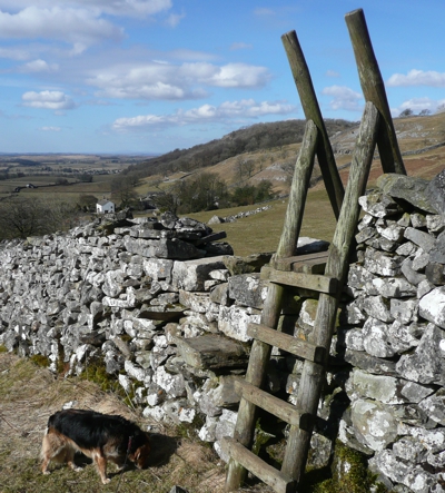
Chris replies: There are a variety of stile
types on A Dales High Way and the Route Guide shows you where the
stiles/gates are located.
In some areas - the Howgill Fells for
example - there are none but in other sections, although they are
gradually being replaced by walkers' gates,some remain. These
include steep ladder stiles, squeeze stiles, wooden step stiles
and step stiles in the dry stone walls.
In the section you mention there are a couple of ladder
stiles that you won't be able to get over with your dog I'm
afraid and some tricky step stiles on the riverbank between
Settle and Stainforth.
Return Visit
From: Margaret Whitehead
Date: 1
September 2019
We walked the Dales High Way for the first time in July 2018.
It was a great experience - lovely scenery in great weather.
We enjoyed it so much that we returned in July 2019, that is
literally returned. We walked from Appleby to Saltaire.
This return journey also gave us an opportunity to try some of
the alternative routes. The cloud was down over the
Howgills so we took the lower level route from Ravenstonedale to
Sedbergh. We still saw many great views.
Also we stayed at Ribblehead rather than Chapel le Dale and
approached Ingleborough from Park Hill and the Simon Fell Ridge.
A lot less adrenaline inducing than the steep ascent/descent of
Ingleborough with time to enjoy the fantastic panorama.
Would like to add the route guidebook was excellent.
Also there seemed to be more way markers on our second trip.
Thank you.
Walking the Way
From: Dave Harrison
Date:
29 May 2019
Hello,
In company with a group organised by HF Holidays, I recently
walked the Dales High Way. There were a couple of hail showers
on the first day, but the weather was otherwise excellent. The
result was a highly enjoyable nine days worth of walking.
To see my photos, visit
http://djh1.webfactional.com/html/walking/Yorkshire_Dales/Dales_High_Way
Regards
Dales High Way - July 2018 Blog
From: Ian
Date:
10 Feb 2019
Hi, In July 2018 I completed my DHW trek, a truly magnificent
walk
Thank you to all who work hard to create, maintain and promote
this path, including of course those running the dedicated
website, which was an endless source of knowledge and inspiration
during the planning stages
I am happy to share my diary/blog of the trip on your forum
and if this in any way encourages others to undertake this
wonderful walk then great – they will not be disappointed!
The link to my site is:
https://hikerdude.dudaone.com/dales-high-way
Happy reading

